The next round of crowdfunding to improve point cloud and elevation data in QGIS is here! Similar to the previous crowdfunding campaign, we have teamed up with North Road and Hobu to improve elevation and point cloud data in QGIS.

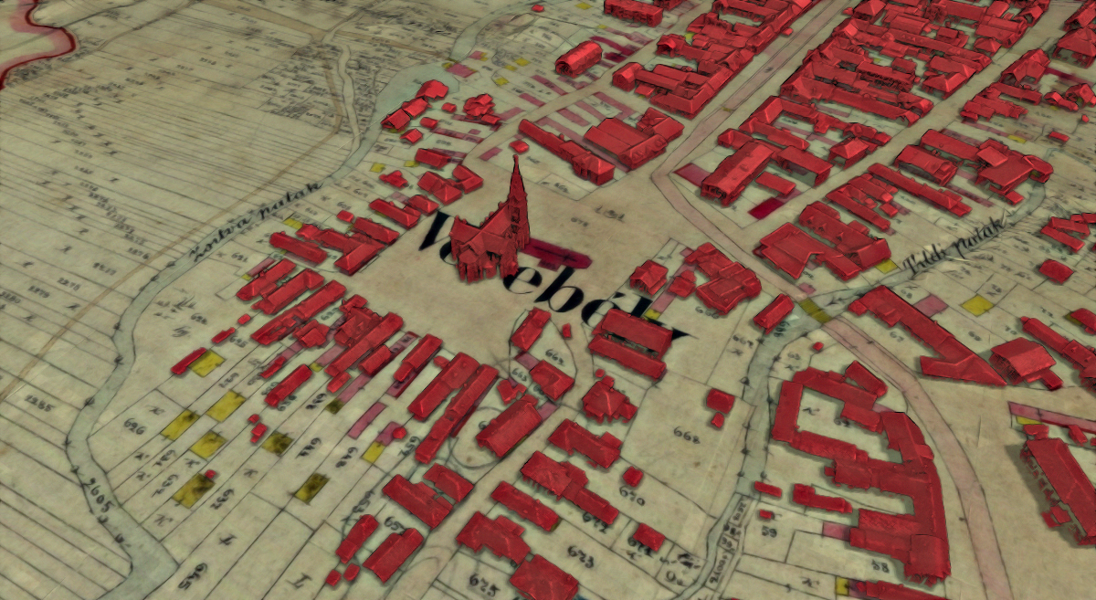
Buildings extracted from lidar, overlaid on top of a cadastral map from 1890. Made by Tibor Lieskovsky, data UGKK SR.
Last year, we added point cloud data to QGIS, thanks to the great support from the community. Based on numerous feedback and suggestions we had over the past year, we have decided to run another campaign to introduce some new tools and enhance user experience when dealing with elevation and point cloud data. Below is a list of those features we intend to introduce. For more details see the crowdfunding page.
Profile tool
A tool for drawing profiles of elevations is essential when working with 3D data, yet it has long been missing from QGIS. While there are several plugins for QGIS that add this missing functionality, unfortunately they all have limitations when it comes to ease of use, performance, integration with the rest of the user interface and wealth of functionality. The goal is to add a profile tool that would cover a wide variety of use cases, and be available immediately out-of-the-box for all QGIS users.


An example of a cross-section: view from the top including the profile line with a buffer, and the profile with two different ways of styling (classification / elevation-based).
Enhanced 2D visualisation of point cloud
A technique that is extremely useful for visualization of point clouds in the 3D map view is the Eye Dome Lighting effect, which adds subtle shading and silhouettes (when there is a greater change of elevation) making it much easier to identify various features of interest that could be otherwise hard to see. To date this feature is only available in 3D QGIS map views, but we would like to introduce it to 2D map view as well! Many GIS workflows and products are still entirely based around 2D views of data (such as digitizing of vector data), so having the extra visual clues which Eye Dome adds is also highly desirable in 2D views.


Top-down 2D view of a classified point cloud. Left: rendering without Eye Dome Lighting (EDL) effect. Right: rendering with EDL.
Filtering point clouds for visualisation
A common requirement of analysts when working with point clouds to work with just a subset of the dataset. This could be as simple as showing only one class of a classified dataset, using only a limited range of elevations, viewing just a particular flight line, or looking at just the first/last returns. Currently, QGIS only provides basic class-based filtering when using rendering based on classification.
Improve 3D map views
One of the limitations is the 3D map view’s window: when it gets closed the configuration of the 3D map view is discarded and any newly opened 3D map view needs to be re-configured again. This is frustrating for users and results in a lot of wasted time! We would like to fix this by keeping 3D views stored in QGIS projects, even when they are not currently being shown. Another issue related to 3D map views is the fact that they are currently only “dock widgets” that can be embedded within the main window. However, often it is preferable to be able to see the 3D view content in a big window, which is quite tricky to do in current QGIS versions (especially when the user does not have multiple displays).
Cloud-optimized point clouds
The new specification of cloud-optimized point clouds (COPC) is current being finalized (October 2021) and it is a very exciting innovation! Inspired by the hugely successful cloud-optimized GeoTIFF (COG) format, the idea is to reuse the existing LAZ format (widely used by the lidar community) and add the improvements which make the format more useful.
More point cloud data formats & more robust loading
While LAS and LAZ files (currently supported by QGIS) are the most common formats for point clouds nowadays, they are not the only ones. In order to support more formats in QGIS we do not need to worry about technical details of each format thanks to the PDAL library. It comes with a multitude of drivers for various formats and services - see https://pdal.io/stages/readers.html . In QGIS we need to provide a user interface to allow people to get other additional formats to work. Some drivers are always available in PDAL, others are optional and may need extra third-party libraries in order to work. We welcome feedback from the community regarding drivers they consider important.
About the crowdfunding campaign
Please visit the crowdfunding page for more details about the campaign!
You may also like...
Mergin Maps, a field data collection app based on QGIS. Mergin Maps makes field work easy with its simple interface and cloud-based sync. Available on Android, iOS and Windows.

